
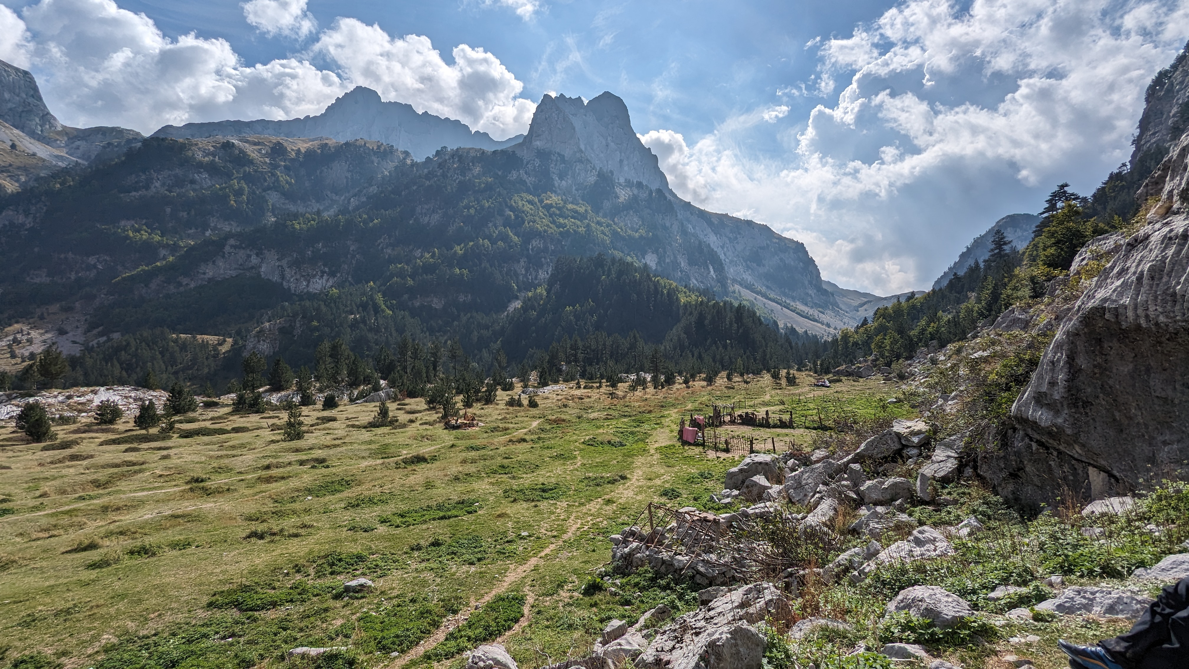
The word for today was “Trees”. Lots and lots of trees.
Today was almost all in commercial forest - Newcastleton Forest on the Scpttish side and Kielder Forest on the English side. They both look the same, though.
By way of a change, and after visiting the village Costcutter, I set off in the correct direction in ordinary kit, that is to say, not full waterproofs. Any dripping was from the forehead, ears, eyes, neck……
I marched up the road to Dykecrofts, a centre for mountain bikers. There were lots of signs, including one which said “Cross Border Route”, pointing towards the Isle of Man. I assumed this would turn into the correct direction so I followed it uphill. And it did! Ecky thump, as they say in parts of Preston (still) – onwards to – a dead end. I found a steep track zig-zagging downhill to another forestry road with a sign saying “Cross Border Route” pointing towards the Isle of Man. If I followed this, I would surely complete a circle. Who knows what disasters may befall should the circle be ever-decreasing. I turned towards Moscow and gradually we (that is, me, I usually see double without my specs on) – slowly we (me) made our way towards the old drovers road (auld droverrrrrs rrrrrooad) that leads to England.

I (we) plodded uphill to an auld rrrrradio station where, according to the map, a few hundred metres or so South would lie a good path to the summit of Larriston Fell. It was a lie. I knew it was a lie, I’d been here before, some years ago. I sort of half-hoped that a path might have formed. No. Not on your nelly it hasn’t. The heather is knee deep. In between the lethal bogs its knee deep anyway. I struggled and huffed and altered direction in a fruitless and pathetic search for a sheep track. Or anything. No chance pal. I eventually struggled up to the trig point, did a GPS thingy on the route through a forest break which would be the shortest route to another forestry road and which had this notional path running down it. It was going to be rough. It was rough. Gwan – ask me how rough it was.

Eventually, after a couple of nervous breakdowns and a Mars bar, I arrived, according to the GPS. A fence over to the West looked like it might have a gate. It didn’t but below the forest had been clear-felled to brash and through the middle of the havoc and destruction, a clear, yellow path squiggled and squirmed towards Kielder. I hade for it, bashing through the twigs and logs and bits of foresters arms and legs and stuff, so distinctive of apprentice chain saw operators and eventually got to the path. It was just two feet wide. I followed it. It arrived, after a while at three mountain bikers and a foresty road. They told me the path was a new mountain bike path to Bloody Bush. Well fit me with a false identity. Course it was. I knew that.
I headed North east on good forest tracks that shadowed the Border. There was a crossing into England, and another into Scotland, then back into England. These are the Debateable Lands.

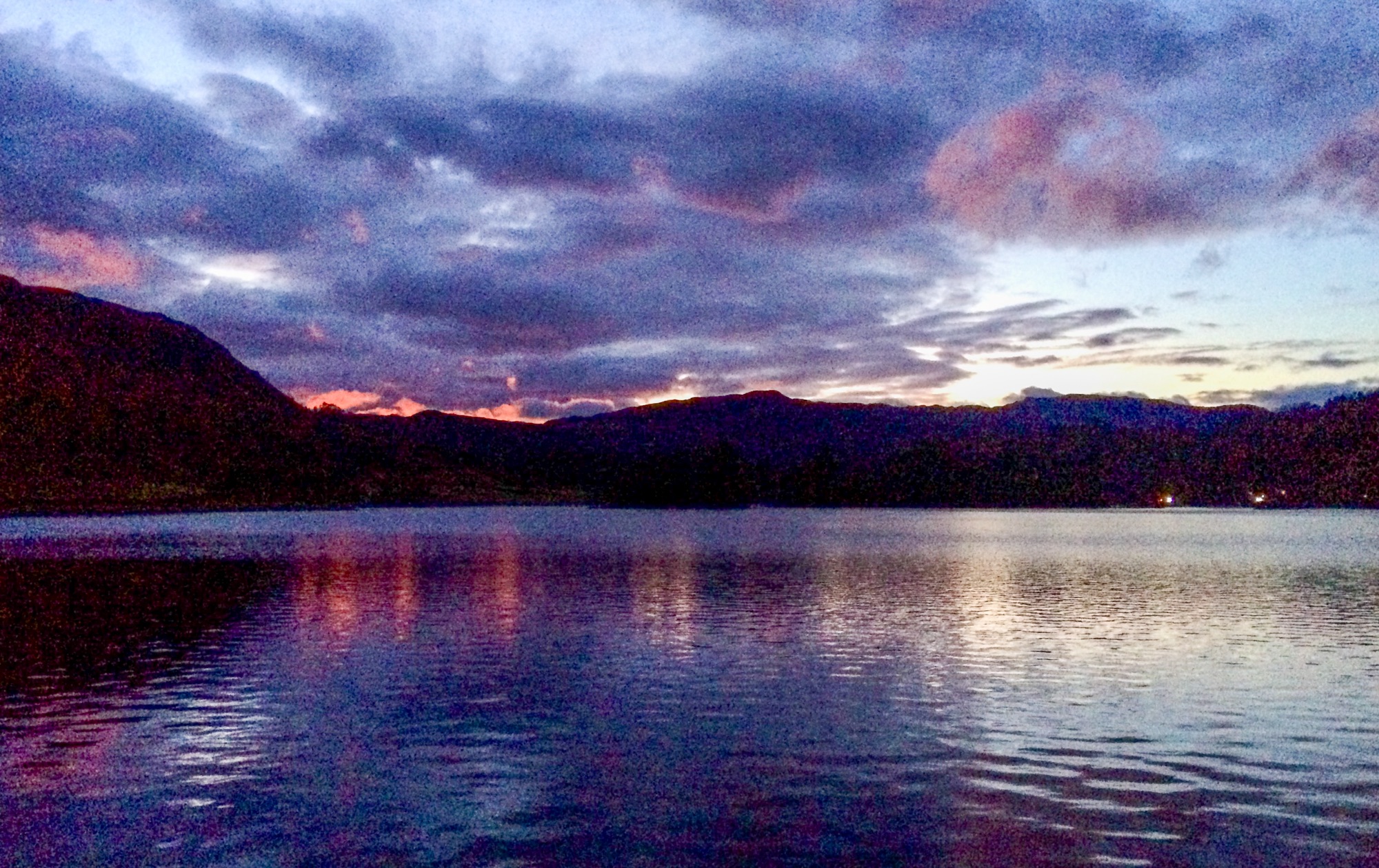
Soon, I was on the campsite with warnings about midgies. I camped for a bit then limped off badly to the Anglers Arms, luckily not too far away. I seem to have acquired some kind of non-blister-like lump on my foot. If I stop walking it swells up and I can;t start again.
Dinner, at the Anglers Arms, though, is good scoff and good value and I allow myself to be exploited to the tune of a chicken pie and several pints of Spitfire and I watched the first half of an England footy match. But soon home to bed with my poorly foot.
Today was 15 Miles and 1900 feet and it only rained for about an hour. That’s good innit?


.jpg)

.jpg)


.jpg)


2 comments:
From the map 14 of those miles must have been in between trees. Nice looking walk still.
Yes martin - Lots and lots of trees, although there are more spaces than the map shows as there's a lot of clear felling going on. They use it for fuel, y'know.... (apparently)
Post a Comment