statcounter

Sunday 31 December 2017

Something to do in 2018

yuledog

And you know, many people come up to me and say “Get out of my bathroom I’m calling the police”

Many bloggers (read “some” bloggers) (actually, one blogger) are, currently writing things about “wot I did in 2017” and quoting several statistics such as the number of bananas they ate on their walks, how many times they insulted a herd of cattle and what they’d like to do in a Youth Hostel dorm when all the lights go out.

By way of contrast, I’ve been struggling with my TGO challenge route. I have the route, but measuring and descibing the fecker in understandable terms is, for some reason or other, a real pain in the crampons.

So I gave up.

DSCN2399

Instead, I’ve created a route which joins up several pubs in the Durham Dales. For completeness, the route starts just outsid County Durham, a few yars inside Northumberland, in fact, and ends in North Yorkshire, a similar number of yards beyond the border.

But, for completeness, and to avoid any driving after all that beer, it has an extension to Kirkby Stephen, in Cumbria, which has a railway station quite a distance outside the city centre, nonetheless, but in consolationj, it also has a fine selection of pubs, shops, chippies, cafe’s and public toilets for the entertainment whilst waiting for a train or a bus.

fleetwith - haystacks 006

The route begins at The Lord Crewe Arms at Blanchland and it goes like this:

Blanchland to Edmundbyers 5 miles (2 drinking opportunities (DO’s))

Edmundbyers to Stanhope 9 miles (3 or 4 DOOs)

Stanhope to Rookhope  6 miles (at least 1 DO)

Rookhope to Westgate  4 miles (1 DO  and, possibly the best steaks in Co Durham) (Just sayin’)

Westgat to St Johns Chapel 2 miles (2 DOs and 2 tearooms)

St Johns Chapel to Cowshill 3 miles (1 DO)

Cowshill to Langdon Beck 8 miles (1 DO)

Langdon Beck to High Force 3 miles (1 DO)

High Force to Holwick 2 miles (1 DO)

Holwick to Middleton in Teesdale 4 miles (?4 DO’s)

Middleton in Teesdale to Mickleton 2 miles (?1 DO’s)

Mickleton to Eggleston 3 miles (?2 DO’s)

Eggleston to Romaldkirk 1.5 miles (2 DO’s)

Romaldkirk to Cotherstone 2.5 miles (1 DO)

Cotherstone to Bowes 8 miles (?2 DO’s)

Bowes to Tan Hill 8 miles (1 DO)

Tan Hill to Kirkby Stephen (optional extension) (Multiple DO’s)

RSCN1980

Clearly, I need to explore this further.

The challenge, should anybody be rash enough to take it, would be to attempt to drink in all the establishments on the list which will eventually be published on this very blog. From previous experience, many will be closed when you arrive. There may be too many pubs in one day for comfort and for a happy bladder and some will have been converted into private homes. Others will have grumpy landlords/landladies, and others will be absolute stars.  For those with dogs, they might not let you in and there will be cattle, horses and surly gamekeepers protecting the lives of their grouse and pheasants so they can be killed later.  And you doctor/cardiac nurse/diabetic nurse/dietitian will not approve of this type of thing. But your life is but short anyway. If you don’t die of this, you will die of that, and that could well be a lot worse than this.

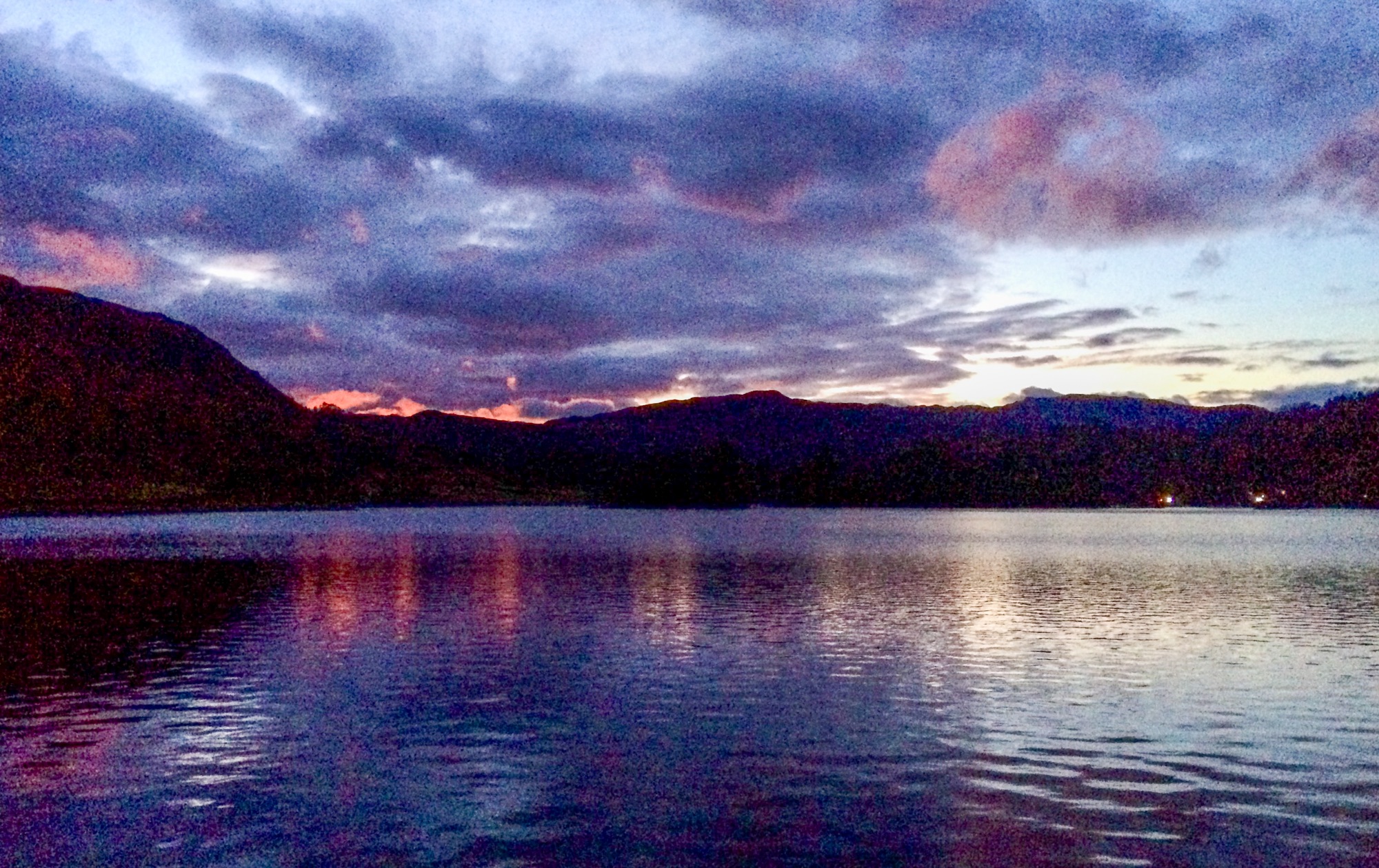
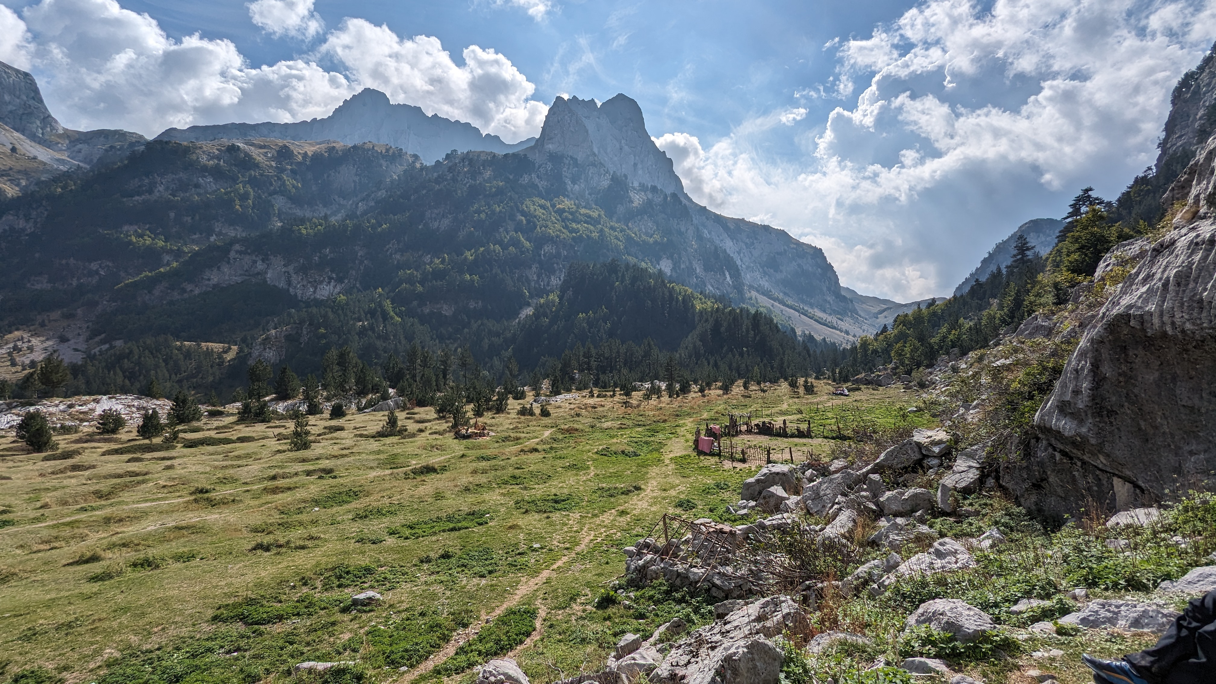
Pics are from 2017 walks in a random order or fashion

Happy New Year.

Thursday 28 December 2017

Yuletide–Loosing the Trousers Up Freeholds Top

DSCN2388
Me and LTD, chauffered by Mrs Pieman, visited Mrs P’s Dad in Halifax over Christmas. No walks were done till Boxing Day, apart from a bijoux bag of one Kail Hill in the gloaming of Christmas Eve on the way. Kail Hill is at Thorpe, quite near Grassington. Mrs P’s satnav had never heard of it and, it is said, that even Scottish raiders on their annual collection of other people’s cattle and daughters and lead by an Australian bloke called Bruce, entirely missed the place whilst on their way to stand outside Skipton Castle shouting naughty words at the Cliffords inside. Such was the obscure geographical location of the place. But I digress/diverse/head in the wrong direction etc.
DSCN2379
Christmas Day was spent quite near Nottingham at a small but lively Knipe enclave which guards Junction 25 on the M1. The Christmas meal was healthy, enjoyable and substantial but the healthiness was completely wrecked by the fact that Mrs Pieman was still driving, thus releasing Yours Truly on the merlot and various fine whiskies.. We repaired to Halifax with dignity almost completely intact. I am mainly speaking of lTD’s and Mrs Pieman’s dignity here you understand. I spent much of the journey home wrapped cosily and snorily in dreamy snoozy sleepyland, as did LTD.
Boxing Day dawned darkly with heavy snow falling, so, after taking LTD on a short, cold and wet constitutional, we jointly agreed that a morning drinking hot coffee and considering bacon butties to be a much better option than waiting for a bus to Todmorden, which was the original plan. So that’s what we did. LTD had chewsticks instead of coffee.
DSCN2364DSCN2366
DSCN2367
By lunchtime, the snow was thawing and the sun was fighting it’s way through the dismalities, so we went  for a walk. We ended up at Luddenden Foot, some six miles away, after crossing Tower Hill and Warley Moor and various lanes and bridleways. The sun came out and, at a distance, it all looks quite beautiful. Close-up, there’s a lot of dereliction and litter, and, basically, crap. We did notice a large lump of cast iron in the approximate shape of an old boiler, plus quite a bit of iron slag on the edge of Warley Moor. It seems, according to this evidence, that there might have been some iron working up here in the deep and dark past. I wonder if anybody has any clues about this? At the moment, the place is moorland and rough pasture with nothing at all to indicate past industry.
We caught the bus back to King Cross in Halifax.
DSCN2383
The next day, we went for our target Tump – one Carr and Craggs Moor, just above Todmorden. Mrs Pieman took us to Toddy in case we suddenly developed Calderdale Lassitude again.
It was much colder, and above about 250 metres, the ground was frozen hard with a thin dusting of fresh snow. We followed the Calderdale Way and then the old toll road towards Bacup, leaving the road, now overwritten by wind-farm roads,  for a plod through frozen tussocks to find the highest point.
DSCN2385DSCN2387
After this, we followed the Limers Gate bridleway to Freehold Top, where my trousers fell down. Y’see, I’ve lost a few kilogrammes (despite the attentions of the various Christmas Kinpes to feed me up) and my beautiful but ancient thermal-lined Rohan kecks are getting a bit loose around the top, so , I had the dog’s lead in one hand, my kecks held up using my other hand whilst my new map case slapped me around the face in the nithering Northerly blasting from somewhere in the approximate direction of Spennymoor.
I did manage to tighten them up later, sufficient for there to be a modicum of dignity on the bus ride back to Halifax. I might have to buy some new winter pants. These are getting quite frayed around the ankles anyway. This could be due to the lower parts dragging along the ground, I suppose.
DSCN2390
We ended the walk with a little trundle beside the Rochdale canal, which leads the baggy-trousered one and his pet dog back to Todmorden city centre without the need to consult any mappage. (If that’s a word) (Which it is now) We caught the bus back to King Cross and walked back to Castle Carter up High Road Well. I appeciate that this will mean nothing to people with no knowledge of the geography of Halifax.
The second walk was 12 miles.
The we went home up the A1(M) and found that some silly bugger had accidentally turned off the freezer. [koff]  Not me. Musta been the dog.

Monday 18 December 2017

Hudderstone–How To Decide To Abandon A Walk

DSCN2361
Sometimes the fates are against a successful conclusion to a  walk. On this occasion it was an innaccurate judgement that the snow wasn’t deep enough for snowshoes, the unnoticed loss of a flask of hot coffee behind the spare wheel in the boot and the march of time. and the carrying of a Garmin GPS which, a bit like Marvin the Robot, began giving passive-aggressive estimates concerning the time we might arrive at the summit of Hudderstone at this rate. The final one being sometime on New Years Eve.
DSCN2348DSCN2351
We began well enough with a navigation error which was fairly quickly noticed and an alternative approach to Hudderstone  developed quickly into A Plan. (This, we will call Plan B for the purposes of absolute clarity) Plan A (the “other” plan) involved climbing the steep slopes of Ward Law (482m), traversing Woodycleuch Dodd (538m) and going on to Hudderstone (626m), descending by the lovely Cowgill Rigg track. Instead, (Plan B), we would follow the road to Coulter Reservoir and clib the ridge next to Snow Gill and follow the ridge over the three hills in the opposite direction to Plan A. If we ran out of time or energy we could descend to the valley at one side or the other, whichever was best at the time.
DSCN2352DSCN2354
The road-walk was easy and soon we were at the foot of the Snow Gill Ridge but soon ran into difficulties. The snow was lying on deep heather and/or tussocks and/or juncus and the effort of uphill movement soon began to get really slow and quite tough. GPS said we’d be at the top by 13:30. Then, after completing all of 50 yards, it said “Actually what I meant was 13:45”. Then, a hundred yards later, it announced that we should certainly arrive by 14:00. Clearly, Things were not going well. And, had we continued, not only would we have exhausted ourselves and our dogs but also there would  have been an issue with daylight and our access to a joint of roast lamb back at Castle Greytowers.
DSCN2356DSCN2357
So we abandoned. I doubt if snowshoes would have made it any easier anyway. The snow was soft and deep and unconsolidated and a spell cast on it overnight, in a fit of merlot-fuelled pique made all the snow melt away overnight, just leaving a thick layer of watery ice.
So, we walked the three and a half miles back to Culter Allers where the car boot was still cuddling my feckin coffee. Happily, Tesco in Lanark has a fine selection of Hogmanay refreshments to cheer-up the disappointed.
DSCN2358DSCN2360
As a consolation prize, we went to the foot of Quothquan Law – a fine green cone by the River Clyde with a hill-fort on the top and a superb view extending to some high and snowy mountains to the North and across to Tinto which had developed a cloudy cap as the sun went down. Quothquan is a much nicer, friendlier hill than Hudderstone. Hudderstone, though, as it happens, on 14 July 2000, was the final hill in my 1990’s quest to climb all the New Donalds and the tops and the deleted ones. I have an entry in an SMC list about it. New Donalds are the modernised version of a list of 2000-foot tops in Scotland South of the Highland line by one Percy Donald.
Quothquan Law has a sign at the bottom announcing the existence of a footpath to the top. However, the stile is inside a hawthorn hedge, defended by barbed wire and the sign blocks the way anyway. Further up the field, the stile is tipped over and there’s a sign warning of cattle, but not of the electric fence. I expect that all this was originally designed to put off the march of Agricola’s legions during his attempted conquest of Caledonia back in the day. Probably very effective, I shouldn’t wonder.
DSCN2363

On the Sunday, on the way home, me and LTD also bagged Craighead Hill (429m), in the drizzle and the hill-fog with only the sound of the M74 rumbling away far below. (Not all that far below, really)
Sometimes, you just have to give up your expedition as a Bad Job. The stars being not right. The list of small things going a bit wrong. The sinking feeling………. Hudderstone is very slow-moving, progressing only at the speed of current continental drift and even my driving will be able to keep pace, so I might have another go sometime. Although Culter Fell itself looked quite a bit more appealing…

Thursday 14 December 2017

Cold Camping in the Cheviots

DSCN2340
Y’see, I’ve bought this ‘ere fabby-whizz down sleeping bag and a thermarest mat to go with it and all it needed was a few empty diary days and a thermometer which barely registered anything at all for there to be some cold-weather camping.
All these things came together a few days ago, so, I collected Dawn from her harbour-side luxury pad in Blyth [koff] and we went up the road to Hethpool at the very foot of the Colledge Valley. Strategically, this was a good move because a) it has a car park and c) (there’s no b) the car park is only just about one mile from some places to camp.
DSCN2333
The sunny and cold morning had changed into a grey and driech one during the short time it took us to find a camping spot and put up the tents. We found a flatish spot with a small stream with a spring of clear water and some shelter from gorse bushes and small hawthorns. A lovely spot.
DSCN2335
So, we had the tents up by lunchtime and, as it had started to snow/sleet/drizzle and it seemed like a good idea to put the kettle on and eat some soup and some paninis with some of that really thinly sliced Italian ham and some nuts and then to doze off listening to the patter of precipitation on the flysheet.
It was disappointingly warm, mainly due to thick cloud cover. Actually, it was still nitheringly cold, but not actually much below zero.  And, it being December, it went dark well before teatime.
I had my radio, a little book, a huge supply of dark rum and a sigg bottle filled with hot water, inserted into a sock and placed in the sleeping bag for extra cosiness.
DSCN2336

By 1:00 am, during a visit by Mr Bladder, I noticed it had gone cold(ish), so I reheated it. By sometime really really dark, the sky had cleared and the previously wet tent had frozen solid. This was More Like It.
Attentive readers might have noticed that LTD was not on this trip. I thought it best to leave him in his bed by the radiator because he doesn’t specially enjoy cold and the forecast was for –10C and for the temperature not to rise much above –2C the next day. In fact, the car temperature gauge had been reading –5C to –2C up to the previous lunchtime.
DSCN2339DSCN2341
The morning was bright and sunny, but, having studied the map for the next camping spots, it seemed that these could be difficult to find and the chances of small streams being frozen solid seemed quite high, so we elected to stay put. Instead we set off to bag 3 little hills just a bit to the North, with light packs and a guaranteed bonny spot with nice water. . Dawn abandoned this walk after half a mile or so but I forged onwards into a thin cover of snow, following the track of a fox or two for a couple of miles. And a hare, and some kind of small deer.
DSCN2342DSCN2343
Three steep little hills followed – Longknowe Hill 346 metres, Longknowe Hill NE Top 327 metres (an unsatisfactory name, surely there must be a local name for this hill as it’s quite distinctive) and Kilham Hill 338 metres.
DSCN2345
It was only a couple of miles back to camp and I contoured the three hills and visited a hill-fort just above our camping spot on the way back. I was back in time for another leisurely lunch and an afternoon snoozathon during which it went dark again.
The next night was warm(ish) and most of the ice melted and a grey dawn struggled to get out of it’s bed, as did I. I wouldn’t have minded staying right there for another day, specially as it started raining halfway through the three –mile return walk (we went back by a longer route)
DSCN2346DSCN2347
A second breakfast/brunch at the Ramblers Cafe in Wooller revealed that a) Its quite cheap and c) (no b) they let dogs in. I have banked this information for future use. Oh, and d) the all-day breakfast was very nice. and e) despite scoffing huge numbers of calories over the previous two days, I was starving hungry.
The walk over the 3 hills was five miles. It would be about 7 if you did it from Hethpool.
More cold camping to come, I shouldn’t wonder.

Sunday 10 December 2017

Advent Adventures–Crook, Weardale and Wansfell Pike

DSCN2330

..Bit of catching up to do here – But I did three Christmas walks in such quick succession that there was no time, or sufficient sobriety to do the blog thing:

DSCN2303

DSCN2318

First up is the Advent Adventure. Originally, this was a walk wot I used to lead for Durham County Council. But, as DCC have got the sack, I did it for the Wednesday Walkers Walking on Saturdays (and Wednesdays) group. It snowed big-time on the reccy in quite a blizzardy sort of way but it was a bit mild and muddy for the 23 peeps wot turned up. Apart from LTD attacking some horses and the blizzard on the reccy, nothing much happened, really; it all went fairly swimmingly. It’s also quite good for St Catherine’s Community Centre’s cafe takings because we have coffee and cakes there afterwards. This is probably why I keep doing it. 8 miles or so…

DSCN2322DSCN2323

And then me and LTD went to Kendal and, deterred from the superb Plan A wot we had, which involved Kirkstone Pass, in favour of the much lower risk of skidding off the road into a huge gaping rocky gorge full of dead cars (a bit like Snake Pass, in fact), we went to Ambleside Rugby Club where it’s much more level and parking is by honesty box donation. For the Lake District, this is brilliant and, probably something I’ll do in the future.

So, we headed for Skellghyll Wood and the Hundreds Road which leads up onto the fell, and thence on up to the summit of Wansfell Pike. The ridge on the top was being blasted by one of the coldest winds I’ve ever met – 35 to 40 mph at –2C, giving a wind-chill of –12C . I thohgt it dfelt colder than that anyway.

DSCN2325DSCN2326

DSCN2327

So, we walked along the ridge, sheltered, at first by the wall and then not sheltered at all, and descended from Baystones to climb a wall giving access to a minor top Dodd Hill and then, conouring round, and fending off the aggressive intentions of a black stallion fell pony wot didn’t like LTD at all (and with good reason, cos LTD would have eaten the horse if it had been mixed with Hero Complete Doggybix), contouring round the hill to descend to the bridleway leading back to Ambleside. 9 Miles.

DSCN2329DSCN2331DSCN2332 

And then, we caught the bus to Wolsingham to join the 16 peeps from Wolsingham Wayfarers for their Christmas foray up the Elephant Trees, down to the Black Bull at Frosterley where LTD managed to spill most of my Oat Stout over mine and others’ rucksacks (I had to buy another one) – and back to Wolsingham with some waving at the Christmas Special (Train to Christmas Town) trains that are running up and down the Weardale line at the moment. And a chap on this walk had driven over Kirkstone Pass the day before, when we’d been up Wansfell and confirmed that in fact, it was, a sheet of ice…

As I’d just missed the bus, I was forced to seek shelter in the Black Lion where diplomatic protocol insisted that I sampled at least three pints of the various ales on offer. LTD accepted a packet of pork scratchings from a friendly customer. Then, having been delayed for 90 minutes, we caught the bus home and told our Mum everything that had happened.

10 and a half miles and four and a quarter pints.